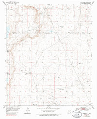
1953 Map of Basin Well
USGS Topo · Published 1986About this map
The high desert landscape along the Chaves and Eddy County line in New Mexico is defined by its critical water sources and emerging petroleum industry during the mid-20th century. While most of the terrain is marked by depressions and tanks like Sink Hole Tank and Double Wells Tank, the southwestern corner reveals the distinct presence of Lake Ishee (Salt Well). The map records a sparse but vital network of windmills and survey markers, including the High Lonesome Windmill and various high points like VABM Cockburn 3799. Human activity is concentrated around extraction, with numerous sites labeled as Oil Well, including several dry and capped locations. These features illustrate the persistent effort to tap the subterranean resources of the Permian Basin, where even isolated landmarks like Basin Well served as essential navigational and industrial waypoints in a feature-sparse environment.
Find a feature on this map
15 named features on this map. Tap any name to fly to it.
Don’t see what you’re looking for? This feature index may not catch every label — zoom into the map to look around manually.
Map Details
Editions of this 1953 Basin Well Map
2 editions found
Other maps of this area

1951 · Ninemile Well
USGS Topo · 1:24,000

1951 · King Camp
USGS Topo · 1:24,000

1951 · Diamond Mound
USGS Topo · 1:24,000

1953 · Basin Well
USGS Topo · 1:24,000

1954 · Carlsbad
USGS Topo · 1:250,000

1954 · Hobbs
USGS Topo · 1:250,000

1954 · Brownfield
USGS Topo · 1:250,000

1955 · Red Lake SE
USGS Topo · 1:24,000

1955 · Roswell
USGS Topo · 1:250,000

1955 · Red Lake
USGS Topo · 1:24,000