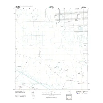
2012 Map of Basinger
USGS Topo · Published 2012About this map
The Kissimmee River meanders across the southern portion of this landscape, anchoring the historic communities of Basinger and Cornwell. This 2012 survey illustrates the transition from traditional river-bound settlements to a more structured rural grid system. Notable for genealogists is the Basinger Cemetery, situated near the riverbanks where early commerce and transport once flourished. The northern half of the map reveals a dense network of numbered roads, such as NW 276th St, indicating modern rural development encroaching on the natural drainage patterns of Ash Slough and Gore Br. Landmarks like Turkey Hammock and Oak Cr reflect the persistent natural character of the Florida prairie, even as agricultural lands are partitioned by the extensive system of NW-designated routes and private holdings like Sherman Ranch Rd.
Find a feature on this map
50 named features on this map. Tap any name to fly to it.
Don’t see what you’re looking for? This feature index may not catch every label — zoom into the map to look around manually.
Map Details
Editions of this 2012 Basinger Map
This is the sole edition of this map. No revisions or reprints were ever made.
Other maps of this area

1952 · Fort Kissimmee
USGS Topo · 1:24,000

1953 · Taylor Creek NW
USGS Topo · 1:24,000

1953 · Basinger
USGS Topo · 1:24,000

1953 · Fort Basinger
USGS Topo · 1:24,000

1953 · Fort Drum SW
USGS Topo · 1:24,000

1953 · Basinger SW
USGS Topo · 1:24,000

1953 · Basinger NW
USGS Topo · 1:24,000

1953 · Taylor Creek SW
USGS Topo · 1:24,000

1953 · Fort Kissimmee SE
USGS Topo · 1:24,000

1956 · Fort Pierce
USGS Topo · 1:250,000