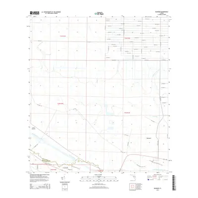
2015 Map of Basinger
USGS Topo · Published 2015About this map
The Kissimmee River defines the southwestern edge of this landscape, carving a boundary between Okeechobee Co and Highlands Co. The small settlement of Basinger serves as a focal point in the southeast, situated near the Basinger Cem and the expansive drainage of Chandler Slough. To the west, the community of Cornwell sits near the riverbank, linked by the path of the Florida National Scenic Trail as it follows the southern border. The interior of the quadrangle is defined by a grid of numbered roads and natural water features like Ash Slough and Turkey Hammock. This map documents a region where agricultural land use and cattle ranching, indicated by Chandler Rnch, exist alongside managed water systems and preserved natural corridors.
Find a feature on this map
46 named features on this map. Tap any name to fly to it.
Don’t see what you’re looking for? This feature index may not catch every label — zoom into the map to look around manually.
Map Details
Editions of this 2015 Basinger Map
This is the sole edition of this map. No revisions or reprints were ever made.
Other maps of this area

1952 · Fort Kissimmee
USGS Topo · 1:24,000

1953 · Taylor Creek NW
USGS Topo · 1:24,000

1953 · Basinger
USGS Topo · 1:24,000

1953 · Fort Basinger
USGS Topo · 1:24,000

1953 · Fort Drum SW
USGS Topo · 1:24,000

1953 · Basinger SW
USGS Topo · 1:24,000

1953 · Basinger NW
USGS Topo · 1:24,000

1953 · Taylor Creek SW
USGS Topo · 1:24,000

1953 · Fort Kissimmee SE
USGS Topo · 1:24,000

1956 · Fort Pierce
USGS Topo · 1:250,000