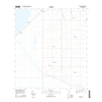
2015 Map of Basinger SW
USGS Topo · Published 2015About this map
Lake Istokpoga dominates the northwest corner of this South Florida landscape, where the waters of the Everglades ecosystem meet managed drainage systems. The settlement of Marland sits near the shore, positioned along CR-621 as it cuts through the flat, low-lying interior of Highlands County. The map documents a complex network of water management, primarily defined by the heavy infrastructure of Canal C-41A and Canal C-41, which bisect the terrain and reshape the natural flow of the Kissimmee River basin.
Find a feature on this map
18 named features on this map. Tap any name to fly to it.
Don’t see what you’re looking for? This feature index may not catch every label — zoom into the map to look around manually.
Map Details
Editions of this 2015 Basinger SW Map
This is the sole edition of this map. No revisions or reprints were ever made.
Other maps of this area

1952 · Lake Placid
USGS Topo · 1:24,000

1952 · Lorida
USGS Topo · 1:24,000

1953 · Basinger
USGS Topo · 1:24,000

1953 · Brighton NW
USGS Topo · 1:24,000

1953 · Fort Basinger
USGS Topo · 1:24,000

1953 · Brighton
USGS Topo · 1:24,000

1953 · Basinger SW
USGS Topo · 1:24,000

1953 · Basinger NW
USGS Topo · 1:24,000

1953 · Childs
USGS Topo · 1:24,000

1956 · Fort Pierce
USGS Topo · 1:250,000