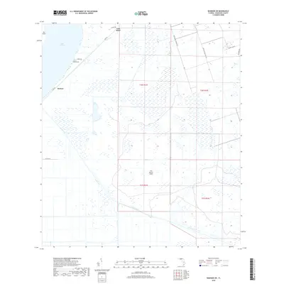
2018 Map of Basinger SW
USGS Topo · Published 2018About this map
Lake Istokpoga dominates the northwestern edge of this landscape, its waters giving way to a complex network of wetlands and drainage systems characteristic of the Florida interior. The settlement at Marland sits near the lakeshore, connected to the surrounding countryside by Co Rd 621 and Godwin Rd. Significant water management is evident through the presence of Canal C-41A and Canal C-41, which cut through the marshy terrain to regulate the local hydrology. Rising slightly above the surrounding wetlands are several named landforms, including Wild Island, Fish Branch Island, and the edge of Big Island. This area in the 2010s reflects the ongoing tension between natural water bodies and agricultural development, as evidenced by the placement of Fort Bassinger Grove Rd and various local thoroughfares like Rattlesnake Hammock Rd and Coon Island Rd.
Find a feature on this map
20 named features on this map. Tap any name to fly to it.
Don’t see what you’re looking for? This feature index may not catch every label — zoom into the map to look around manually.
Map Details
Editions of this 2018 Basinger SW Map
This is the sole edition of this map. No revisions or reprints were ever made.
Other maps of this area

1952 · Lake Placid
USGS Topo · 1:24,000

1952 · Lorida
USGS Topo · 1:24,000

1953 · Basinger
USGS Topo · 1:24,000

1953 · Brighton NW
USGS Topo · 1:24,000

1953 · Fort Basinger
USGS Topo · 1:24,000

1953 · Brighton
USGS Topo · 1:24,000

1953 · Basinger SW
USGS Topo · 1:24,000

1953 · Basinger NW
USGS Topo · 1:24,000

1953 · Childs
USGS Topo · 1:24,000

1956 · Fort Pierce
USGS Topo · 1:250,000