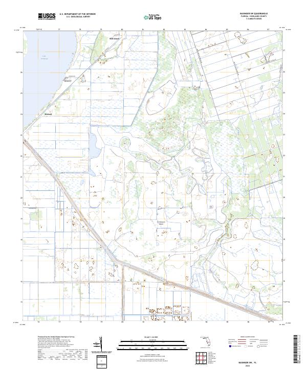
2024 Map of Basinger SW
USGS Topo · Published 2024About this map
Lake Istokpoga dominates the northwestern corner of this Highlands County landscape, where the shoreline meets the settlement of Marland. The area is defined by an intricate network of drainage and water management, notably the prominent Canal C-41A and Canal C-41 which cut diagonally through the terrain. These man-made features contrast with natural high points like Wild Island and Fish Branch Island that rise from the surrounding lowlands. The eastern portion of the map is heavily gridded by agricultural and local access roads, including Fort Bassinger Grove Rd and Rattlesnake Hammock Rd, reflecting the region's long-standing citrus and ranching economy. This 2024 survey captures the precise intersection of Florida's natural wetlands and its engineered agricultural infrastructure.
Find a feature on this map
19 named features on this map. Tap any name to fly to it.
Don’t see what you’re looking for? This feature index may not catch every label — zoom into the map to look around manually.
Map Details
Editions of this 2024 Basinger SW Map
This is the sole edition of this map. No revisions or reprints were ever made.
Other maps of this area

1952 · Lake Placid
USGS Topo · 1:24,000

1952 · Lorida
USGS Topo · 1:24,000

1953 · Basinger
USGS Topo · 1:24,000

1953 · Brighton NW
USGS Topo · 1:24,000

1953 · Fort Basinger
USGS Topo · 1:24,000

1953 · Brighton
USGS Topo · 1:24,000

1953 · Basinger SW
USGS Topo · 1:24,000

1953 · Basinger NW
USGS Topo · 1:24,000

1953 · Childs
USGS Topo · 1:24,000

1956 · Fort Pierce
USGS Topo · 1:250,000