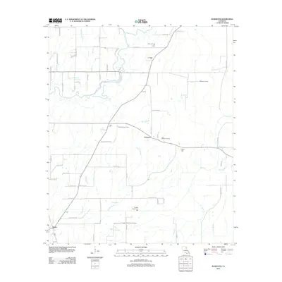
2012 Map of Baskinton
USGS Topo · Published 2012About this map
Baskin and the nearby settlement of Baskinton anchor this 2012 survey of the Franklin Parish landscape, where the agricultural flats are defined by a complex drainage network including Hurricane Bayou, Brushy Bayou, and Turkey Creek. The region’s economic character is visible through several petroleum extraction sites, notably the Baskinton Oil Field and the South Big Creek Oil Field to the north. Local history and genealogy are preserved in the locations of Friendship Cemetery, Union Cemetery, and Pleasant Hall Cemetery. Transportation and infrastructure are represented by Greg's Flying Service Airport and the intricate grid of rural roads like Johnny Walker Road and Bradford Cooper Road. The map also shows the hydrologic management of the area through features such as the Turkey Creek Cut-Off and Ash Slough.
Find a feature on this map
74 named features on this map. Tap any name to fly to it.
Don’t see what you’re looking for? This feature index may not catch every label — zoom into the map to look around manually.
Map Details
Editions of this 2012 Baskinton Map
This is the sole edition of this map. No revisions or reprints were ever made.
Other maps of this area

1935 · Winnsboro
USGS Topo · 1:62,500

1935 · Alto
USGS Topo · 1:62,500

1935 · Baskinton
USGS Topo · 1:62,500

1939 · Fort Necessity
USGS Topo · 1:62,500

1955 · Jackson
USGS Topo · 1:250,000

1957 · Mangham
USGS Topo · 1:62,500

1958 · Baskinton
USGS Topo · 1:62,500

1958 · Winnsboro
USGS Topo · 1:62,500

1958 · Fort Necessity
USGS Topo · 1:62,500

1961 · Jackson
USGS Topo · 1:250,000