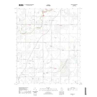
2020 Map of Baskinton
USGS Topo · Published 2020About this map
The boundary between Richland and Franklin Parishes cuts through this landscape of the Mississippi Delta, where the settlement of Baskin and the smaller community of Baskinton serve as the primary hubs. This modern record shows a terrain deeply shaped by water management, defined by a complex network of bayous and man-made alterations. Significant watercourses like Hurricane Bayou and Brushy Bayou wind through the region, while the Turkey Creek Cut-Off reflects modern efforts to control drainage and flooding.
Find a feature on this map
75 named features on this map. Tap any name to fly to it.
Don’t see what you’re looking for? This feature index may not catch every label — zoom into the map to look around manually.
Map Details
Editions of this 2020 Baskinton Map
This is the sole edition of this map. No revisions or reprints were ever made.
Other maps of this area

1935 · Winnsboro
USGS Topo · 1:62,500

1935 · Alto
USGS Topo · 1:62,500

1935 · Baskinton
USGS Topo · 1:62,500

1939 · Fort Necessity
USGS Topo · 1:62,500

1955 · Jackson
USGS Topo · 1:250,000

1957 · Mangham
USGS Topo · 1:62,500

1958 · Baskinton
USGS Topo · 1:62,500

1958 · Winnsboro
USGS Topo · 1:62,500

1958 · Fort Necessity
USGS Topo · 1:62,500

1961 · Jackson
USGS Topo · 1:250,000