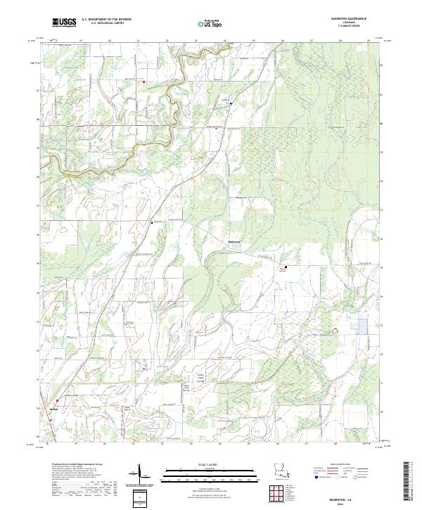
2024 Map of Baskinton
USGS Topo · Published 2024About this map
The boundary between Richland Parish and Franklin Parish divides this stretch of the Louisiana delta, where a complex network of bayous and sloughs defines the agricultural landscape. The settlement of Baskinton serves as a local hub, situated amidst a grid of parish roads named for regional families, such as Bradford Cooper Rd and Delmas McMurray Rd. This territory is heavily marked by its water-management history, notably at the Turkey Creek Cut-Off and the winding course of Hurricane Bayou.
Find a feature on this map
75 named features on this map. Tap any name to fly to it.
Don’t see what you’re looking for? This feature index may not catch every label — zoom into the map to look around manually.
Map Details
Editions of this 2024 Baskinton Map
This is the sole edition of this map. No revisions or reprints were ever made.
Other maps of this area

1935 · Winnsboro
USGS Topo · 1:62,500

1935 · Alto
USGS Topo · 1:62,500

1935 · Baskinton
USGS Topo · 1:62,500

1939 · Fort Necessity
USGS Topo · 1:62,500

1955 · Jackson
USGS Topo · 1:250,000

1957 · Mangham
USGS Topo · 1:62,500

1958 · Baskinton
USGS Topo · 1:62,500

1958 · Winnsboro
USGS Topo · 1:62,500

1958 · Fort Necessity
USGS Topo · 1:62,500

1961 · Jackson
USGS Topo · 1:250,000