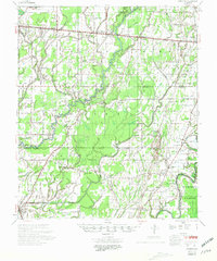
1958 Map of Baskinton
USGS Topo · Published 1974About this map
The low-lying wetlands of Richland Parish and Franklin Parish define this 1958 survey, where the Boeuf River and Bayou Macon snake through a landscape of dense sloughs and alluvial bottomlands. The Illinois Central railroad cuts a straight line across the northern terrain, anchoring the settlements of Holly Ridge, Dunn, and Delhi. This period reveals an active industrial footprint in the Louisiana backcountry, with the Southwest Delhi Oil Field and South Big Creek Oil Field marked by numerous wells and pipelines alongside the natural drainage of Big Creek.
Find a feature on this map
79 named features on this map. Tap any name to fly to it.
Don’t see what you’re looking for? This feature index may not catch every label — zoom into the map to look around manually.
Map Details
Editions of this 1958 Baskinton Map
2 editions found

Other maps of this area

1935 · Collinston
USGS Topo · 1:62,500

1935 · Winnsboro
USGS Topo · 1:62,500

1935 · Alto
USGS Topo · 1:62,500

1935 · Baskinton
USGS Topo · 1:62,500

1935 · Hurricane
USGS Topo · 1:62,500

1935 · Waverly
USGS Topo · 1:62,500

1935 · Shackleford Lake
USGS Topo · 1:62,500

1939 · Fort Necessity
USGS Topo · 1:62,500

1955 · Jackson
USGS Topo · 1:250,000

1957 · Mangham
USGS Topo · 1:62,500