
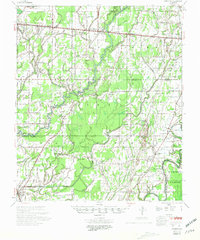
1958 Map of Baskinton
USGS Topo · Published 1958About this map
The Illinois Central railroad corridor anchors this mid-century look at the northeast Louisiana landscape, connecting the growing hubs of Rayville, Holly Ridge, and Delhi. The region is defined by a complex web of waterways, most notably the meandering course of Bayou Macon and its associated sloughs and brakes like Wildcat Slough and Bakers Brake. This era marks a significant industrial expansion in the area, evidenced by the proliferation of energy infrastructure including the Dehlco Oil Field, the West Delhi Gas Field, and the operations of the Delhi Refining Co.
Find a feature on this map
80 named features on this map. Tap any name to fly to it.
Don’t see what you’re looking for? This feature index may not catch every label — zoom into the map to look around manually.
Map Details
Editions of this 1958 Baskinton Map
2 editions found
Other maps of this area

1935 · Collinston
USGS Topo · 1:62,500

1935 · Winnsboro
USGS Topo · 1:62,500

1935 · Alto
USGS Topo · 1:62,500

1935 · Baskinton
USGS Topo · 1:62,500

1935 · Hurricane
USGS Topo · 1:62,500

1935 · Waverly
USGS Topo · 1:62,500

1935 · Shackleford Lake
USGS Topo · 1:62,500

1939 · Fort Necessity
USGS Topo · 1:62,500

1955 · Jackson
USGS Topo · 1:250,000

1957 · Mangham
USGS Topo · 1:62,500