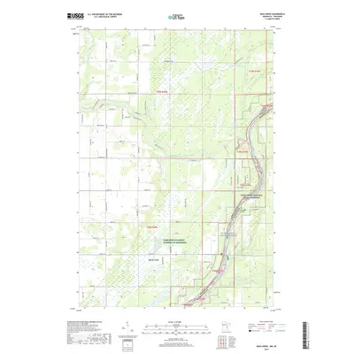
2019 Map of Bass Creek
USGS Topo · Published 2019About this map
Rock Creek serves as a primary settlement point on this 2019 survey of the Minnesota-Wisconsin borderlands. The landscape is defined by the winding course of the Snake River, which flows through the center of the quadrangle to join the St. Croix Wild and Scenic River. This riparian corridor is protected as part of the Saint Croix National Scenic Riverway, a significant conservation area that straddles the state line. North of the river junction, the terrain includes Seven Islands and numerous smaller watercourses such as Bear Cr and Bass Cr. A notable portion of the central region is identified as Farm Service Agency Interest of Minnesota, indicating a distinct land management pattern. The road network, including Chengwatana Rd and Evergreen Rd, provides access across the wetlands and forested areas surrounding Green Swamp.
Find a feature on this map
73 named features on this map. Tap any name to fly to it.
Don’t see what you’re looking for? This feature index may not catch every label — zoom into the map to look around manually.
Map Details
Editions of this 2019 Bass Creek Map
This is the sole edition of this map. No revisions or reprints were ever made.
Other maps of this area

1950 · Rush City
USGS Topo · 1:48,000

1950 · Grantsburg
USGS Topo · 1:48,000

1951 · Milltown
USGS Topo · 1:48,000

1953 · Stillwater
USGS Topo · 1:250,000

1955 · Rush City
USGS Topo · 1:62,500

1955 · Milltown
USGS Topo · 1:62,500

1955 · Stillwater
USGS Topo · 1:250,000

1958 · Stillwater
USGS Topo · 1:250,000

1961 · Pine City
USGS Topo · 1:62,500

1962 · Grantsburg
USGS Topo · 1:62,500