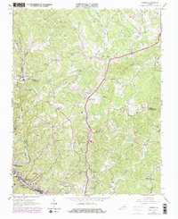
1965 Map of Bassett
USGS Topo · Published 1978About this map
Bassett and North Bassett anchor the southwestern corner of this survey, where the Norfolk And Western River and the Norfolk and Western railroad line carve through the valley. The landscape is defined by its drainage network, with Town Creek, Grassy Fork, and Reed Creek cutting across the central and eastern portions. A series of family-named landmarks and rural institutions, such as Thornton Cem and Pearson Cem, suggest a deeply rooted community structure, while the Indefinite Boundary between Franklin Co and Henry Co traverses the northern reaches.
Find a feature on this map
39 named features on this map. Tap any name to fly to it.
Don’t see what you’re looking for? This feature index may not catch every label — zoom into the map to look around manually.
Map Details
Editions of this 1965 Bassett Map
Other maps of this area

1924 · Martinsville
USGS Topo · 1:48,000

1925 · Rocky Mount
USGS Topo · 1:48,000

1926 · Martinsville
USGS Topo · 1:62,500

1926 · Critz
USGS Topo · 1:48,000

1927 · Rocky Mount
USGS Topo · 1:62,500

1927 · Martinsville
USGS Topo · 1:62,500

1928 · Critz
USGS Topo · 1:62,500

1944 · Martinsville
USGS Topo · 1:62,500

1944 · Rocky Mount
USGS Topo · 1:62,500

1953 · Winston-Salem
USGS Topo · 1:250,000