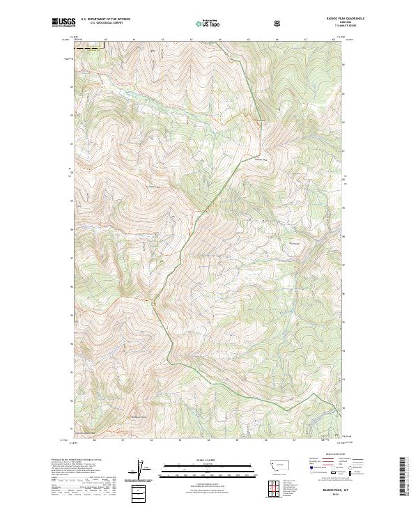
2024 Map of Bassoo Peak
USGS Topo · Published 2024About this map
Lolo National Forest encompasses the dramatic terrain of the Cabinet Mountains in this modern survey of the Montana high country. The landscape is defined by a series of prominent summits, including Snowstorm Mtn, Thompson Peak, and the namesake Bassoo Peak. A sophisticated network of trails, such as the Reservation Divide Trl and Big Rock Creek Trl, suggests a wilderness managed for both conservation and recreation. The presence of the Wilder Creek Ditch in the lower elevations provides a subtle hint of historical water management and land use within the rugged drainages of Bear Creek and Chippy Creek. The map also documents the boundary between Flathead Co and Sanders Co, where steep ridgelines like Snowstorm Ridge separate major watersheds.
Find a feature on this map
30 named features on this map. Tap any name to fly to it.
Don’t see what you’re looking for? This feature index may not catch every label — zoom into the map to look around manually.
Map Details
Editions of this 2024 Bassoo Peak Map
This is the sole edition of this map. No revisions or reprints were ever made.
Other maps of this area

1956 · Wallace
USGS Topo · 1:250,000

1960 · Wallace
USGS Topo · 1:250,000

1964 · Mill Pocket Creek
USGS Topo · 1:24,000

1964 · Coney Peak
USGS Topo · 1:24,000

1964 · Hubbart Reservoir
USGS Topo · 1:24,000
1964 · Cook Mountain
USGS Topo · 1:24,000
1964 · Shroder Creek
USGS Topo · 1:24,000

1964 · Murr Peak
USGS Topo · 1:24,000

1964 · Lonepine
USGS Topo · 1:24,000
1964 · Bassoo Peak
USGS Topo · 1:24,000