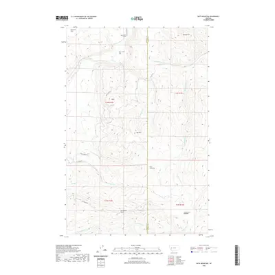
2020 Map of Bata Mountain
USGS Topo · Published 2020About this map
The Blackfoot River winds through the northwestern corner of this Missoula and Powell County borderland, defining a landscape of high timbered ridges and alluvial flats. Notable level ground is found at Blanchard Flats and Bear Creek Flat, while the higher elevations are marked by prominent peaks such as Bata Mtn and Lost Horse Mtn. The transport network relies on a system of forest roads, including Sperry Grade Rd and Cap Wallace Rd, which provide access to remote areas like Cap Wallace Gulch. To the southeast, the terrain opens into Chamberlain Meadows, a significant highland clearing. The map details the complex drainage system feeding the river, from W Fork Bear Cr to the headwaters of Little Fish Cr, illustrating the watershed's topographical importance in this part of Montana.
Find a feature on this map
29 named features on this map. Tap any name to fly to it.
Don’t see what you’re looking for? This feature index may not catch every label — zoom into the map to look around manually.
Map Details
Editions of this 2020 Bata Mountain Map
This is the sole edition of this map. No revisions or reprints were ever made.
Other maps of this area

1902 · Ovando
USGS Topo · 1:125,000

1905 · Ovando
USGS Topo · 1:125,000

1919 · Drummond
USGS Topo · 1:125,000

1921 · Drummond
USGS Topo · 1:125,000

1947 · Butte
USGS Topo · 1:250,000

1955 · Choteau
USGS Topo · 1:250,000

1957 · Choteau
USGS Topo · 1:250,000

1958 · Butte
USGS Topo · 1:250,000

1958 · Choteau
USGS Topo · 1:250,000

1960 · Butte
USGS Topo · 1:250,000