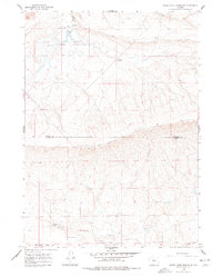
1959 Map of Bates Creek Reservoir
USGS Topo · Published 1978About this map
Bates Creek Reservoir and its surrounding drainage basin define this high-altitude landscape along the border of Natrona and Carbon counties. In 1959, the area reflects a working landscape of ranching and resource extraction, anchored by the Two Bar Camp to the north and a designated Mining Camp further south. The topography is dominated by the prominent Moss Agate Ridge, which provides a geographic backdrop for the sparse network of unimproved roads and the Landing Strip. The presence of the Old Bates site near the Casper Road suggests an earlier phase of settlement or commerce in this basin. Water management is central to the area's utility, visible through several labeled springs and the southern Percy Reservoir. The map captures a moment when industrial activity, evidenced by a Drill Hole, coexisted with the traditional cattle-camp culture of the Wyoming interior.
Find a feature on this map
14 named features on this map. Tap any name to fly to it.
Don’t see what you’re looking for? This feature index may not catch every label — zoom into the map to look around manually.
Map Details
Editions of this 1959 Bates Creek Reservoir Map
3 editions found
Other maps of this area

1955 · Casper
USGS Topo · 1:250,000

1958 · Casper
USGS Topo · 1:250,000

1959 · Moss Agate Reservoir
USGS Topo · 1:24,000

1959 · Squaw Spring
USGS Topo · 1:24,000

1959 · Chalk Hills
USGS Topo · 1:24,000

1959 · Bates Creek Reservoir
USGS Topo · 1:24,000

1960 · Sheep Creek
USGS Topo · 1:24,000

1960 · Mud Springs
USGS Topo · 1:24,000

1960 · Measel Spring Reservoir
USGS Topo · 1:24,000

1960 · Ice Cave Mountain
USGS Topo · 1:24,000