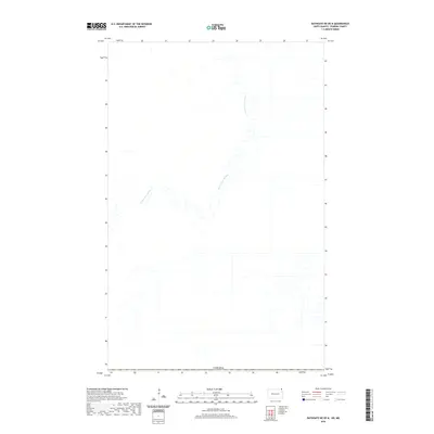
2020 Map of Bathgate NE OE N
USGS Topo · Published 2020About this map
The Rivière aux Marais winds through this northern borderland landscape along the boundary with Canada. This area is characterized by a sparse, geometric road network and agricultural drainage patterns typical of the Red River Valley’s flat terrain. Surveyed in the 21st century, the map illustrates the precise division of land where North Dakota meets Manitoba. The winding path of the river provides a striking visual contrast to the rigid section lines of the surrounding farmland, showing how natural hydrology continues to define the landscape even in a highly engineered agricultural region.
Find a feature on this map
2 named features on this map. Tap any name to fly to it.
Don’t see what you’re looking for? This feature index may not catch every label — zoom into the map to look around manually.
Map Details
Editions of this 2020 Bathgate NE OE N Map
This is the sole edition of this map. No revisions or reprints were ever made.
Other maps of this area

1939 · Pembina
USGS Topo · 1:62,500

1941 · Bathgate
USGS Topo · 1:62,500

1941 · Pembina
USGS Topo · 1:62,500

1952 · Thief River Falls
USGS Topo · 1:250,000

1956 · Thief River Falls
USGS Topo · 1:250,000

1957 · Thief River Falls
USGS Topo · 1:250,000

1967 · Thief River Falls
USGS Topo · 1:250,000
1970 · Bathgate NE
USGS Topo · 1:24,000
1971 · Bathgate
USGS Topo · 1:24,000
1972 · Pembina
USGS Topo · 1:24,000