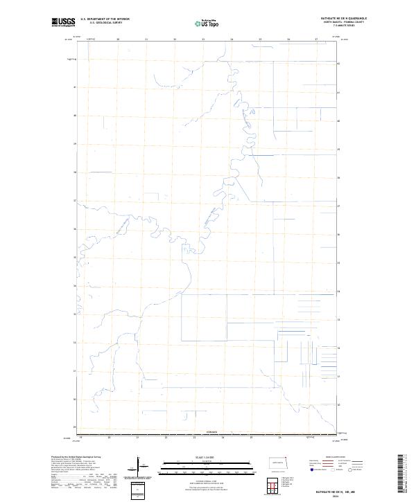
2024 Map of Bathgate NE OE N
USGS Topo · Published 2024About this map
The Rivière aux Marais winds through this northern stretch of Pembina County, creating a serpentine drainage pattern across the low-lying terrain. This 2024 survey captures the landscape as it meets the international border with Canada, defined by the geometric precision of the Public Land Survey System and a network of rural roads that square the territory into agricultural parcels. The lack of named settlements emphasizes the rural character of this borderland, where the primary topographic interest lies in the meandering watercourse and the irrigation and drainage infrastructure visible in the surrounding fields.
Find a feature on this map
2 named features on this map. Tap any name to fly to it.
Don’t see what you’re looking for? This feature index may not catch every label — zoom into the map to look around manually.
Map Details
Editions of this 2024 Bathgate NE OE N Map
This is the sole edition of this map. No revisions or reprints were ever made.
Other maps of this area

1939 · Pembina
USGS Topo · 1:62,500

1941 · Bathgate
USGS Topo · 1:62,500

1941 · Pembina
USGS Topo · 1:62,500

1952 · Thief River Falls
USGS Topo · 1:250,000

1956 · Thief River Falls
USGS Topo · 1:250,000

1957 · Thief River Falls
USGS Topo · 1:250,000

1967 · Thief River Falls
USGS Topo · 1:250,000
1970 · Bathgate NE
USGS Topo · 1:24,000
1971 · Bathgate
USGS Topo · 1:24,000
1972 · Pembina
USGS Topo · 1:24,000