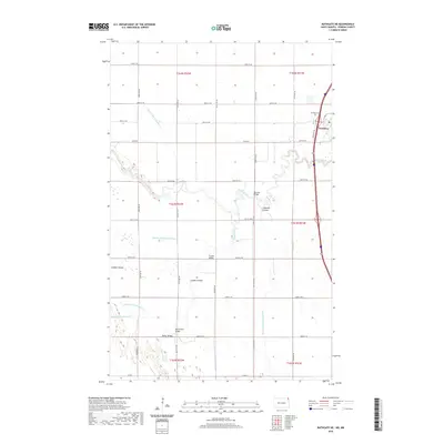
2020 Map of Bathgate NE
USGS Topo · Published 2020About this map
Pembina sits at the confluence of the north-flowing Red River (beyond the map edge) and the winding Pembina River, a critical point of early settlement and commerce in North Dakota. This landscape is defined by its complex water management system, where the naturally meandering courses of the Tongue River and various coulees are augmented by a rigid grid of drainage projects, including County Ditch Number 11 and County Ditch Number 42.
Find a feature on this map
37 named features on this map. Tap any name to fly to it.
Don’t see what you’re looking for? This feature index may not catch every label — zoom into the map to look around manually.
Map Details
Editions of this 2020 Bathgate NE Map
This is the sole edition of this map. No revisions or reprints were ever made.
Other maps of this area

1939 · Pembina
USGS Topo · 1:62,500

1941 · Bathgate
USGS Topo · 1:62,500

1941 · Pembina
USGS Topo · 1:62,500

1952 · Thief River Falls
USGS Topo · 1:250,000

1956 · Thief River Falls
USGS Topo · 1:250,000

1957 · Thief River Falls
USGS Topo · 1:250,000

1967 · Thief River Falls
USGS Topo · 1:250,000
1970 · Bathgate SE
USGS Topo · 1:24,000
1970 · Bathgate NE
USGS Topo · 1:24,000
1971 · Bathgate
USGS Topo · 1:24,000