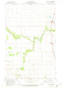
1970 Map of Bathgate NE
USGS Topo · Published 1973About this map
Pembina River meanders sharply across this Red River Valley landscape, just south of the international border with Canada. In the early 1970s, this area north of Pembina shows a transition in transportation and land management, where the Northern Burlington tracks and new interstate interchanges, such as the Pembina Interchange, cross an older network of named river crossings. Several family-named or local landmarks are documented, including Hancock Bridge, Trudell Bridge, and the DeMars Bridge spanning the southern waterways.
Find a feature on this map
24 named features on this map. Tap any name to fly to it.
Don’t see what you’re looking for? This feature index may not catch every label — zoom into the map to look around manually.
Map Details
Editions of this 1970 Bathgate NE Map
This is the sole edition of this map. No revisions or reprints were ever made.
Other maps of this area

1939 · Pembina
USGS Topo · 1:62,500

1941 · Bathgate
USGS Topo · 1:62,500

1941 · Pembina
USGS Topo · 1:62,500

1952 · Thief River Falls
USGS Topo · 1:250,000

1956 · Thief River Falls
USGS Topo · 1:250,000

1957 · Thief River Falls
USGS Topo · 1:250,000

1967 · Thief River Falls
USGS Topo · 1:250,000
1970 · Bathgate SE
USGS Topo · 1:24,000
1971 · Bathgate
USGS Topo · 1:24,000
1971 · Hamilton
USGS Topo · 1:24,000