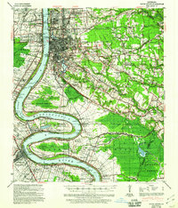
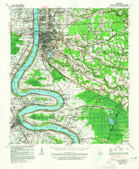
1939 Map of Baton Rouge
USGS Topo · Published 1960About this map
Baton Rouge serves as the focal point of this pre-war survey, documenting the city's transition from a river-oriented trade hub to an expanding regional center. The map captures the dense network of plantations that once lined the Mississippi River, including Poplar Grove Plantation, St Louis Plantation, and Granada Plantation, many of which were still distinct entities before late-century industrial development. Beyond the city grid, the landscape is defined by the winding paths of Bayou Manchac and Bayou Duplantier, and the complex rail infrastructure of the Yazoo and Mississippi Valley Railroad and Louisiana and Arkansas Railway.
Find a feature on this map
119 named features on this map. Tap any name to fly to it.
Don’t see what you’re looking for? This feature index may not catch every label — zoom into the map to look around manually.
Map Details
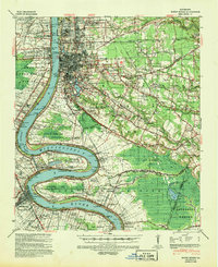
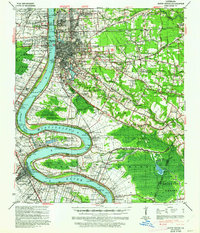
Editions of this 1939 Baton Rouge Map
4 editions found
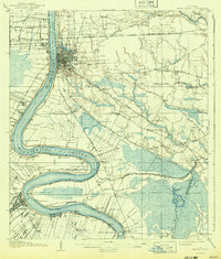
Historical Maps of Baton Rouge Through Time
9 maps found
1908 Baton Rouge
East Baton Rouge Parish, LA
1939 Baton Rouge
East Baton Rouge Parish, LA
1954 Baton Rouge
East Baton Rouge Parish, LA

1956 Baton Rouge
East Baton Rouge Parish, LA

1961 Baton Rouge
East Baton Rouge Parish, LA

1962 Baton Rouge
East Baton Rouge Parish, LA
1963 Baton Rouge
East Baton Rouge Parish, LA
1965 Baton Rouge
East Baton Rouge Parish, LA

1984 Baton Rouge
East Baton Rouge Parish, LA