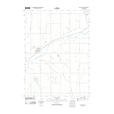
2010 Map of Battle Creek
USGS Topo · Published 2010About this map
Battle Creek sits at the confluence of the Maple River and its eponymous tributary, serving as the primary anchor for this rural landscape. The settlement is clearly defined by its central Battle Creek Post Office and the northern Mount Hope Cemetery, while the surrounding terrain transitions into the broad agricultural expanse of Pleasant Valley. A distinctive grid of county roads, named with a mix of avian and presidential themes like Eagle Ave, Dove Ave, and Dodge Ave, reflects the organized land division of the Iowa prairie. The map captures the area's hydrology in detail, following the meandering paths of East Aldrich Creek and Lund Creek as they feed toward the river valley. To the northeast, the Ida County Fairgrounds and Grell Pond mark the outskirts of the neighboring community, illustrating the civic and recreational infrastructure of the early 21st century.
Find a feature on this map
33 named features on this map. Tap any name to fly to it.
Don’t see what you’re looking for? This feature index may not catch every label — zoom into the map to look around manually.
Map Details
Editions of this 2010 Battle Creek Map
This is the sole edition of this map. No revisions or reprints were ever made.
Other maps of this area

1954 · Fort Dodge
USGS Topo · 1:250,000

1957 · Fort Dodge
USGS Topo · 1:250,000

1958 · Fort Dodge
USGS Topo · 1:250,000

1967 · Holstein
USGS Topo · 1:24,000

1967 · Ida Grove
USGS Topo · 1:24,000

1967 · Battle Creek
USGS Topo · 1:24,000

1967 · Ida Grove NW
USGS Topo · 1:24,000

1969 · Danbury
USGS Topo · 1:24,000

1969 · Holstein SW
USGS Topo · 1:24,000

1969 · Cushing
USGS Topo · 1:24,000