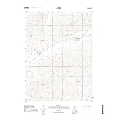
2018 Map of Battle Creek
USGS Topo · Published 2018About this map
Battle Creek sits at the intersection of several regional waterways and local roads in Ida County, where the Maple River meets the valley floor. The town's grid is established north of the river, with Mount Hope Cem situated on the western edge of the settlement. The surrounding landscape is defined by the drainage patterns of Battle Cr, Lund Cr, and Crawford Creek, which carve through the Iowa countryside. Prominent elevations like Battle Hill rise above the alluvial plains, while Pleasant Valley extends to the southeast. The map reveals a robust network of county roads, including Co RD d50 and Co RD d59, which connect these agricultural lands. To the northeast, Gsell Pond provides a rare contained water feature in a terrain otherwise dominated by the serpentine paths of the river and its many tributaries like E Aldrich Cr.
Find a feature on this map
38 named features on this map. Tap any name to fly to it.
Don’t see what you’re looking for? This feature index may not catch every label — zoom into the map to look around manually.
Map Details
Editions of this 2018 Battle Creek Map
This is the sole edition of this map. No revisions or reprints were ever made.
Other maps of this area

1954 · Fort Dodge
USGS Topo · 1:250,000

1957 · Fort Dodge
USGS Topo · 1:250,000

1958 · Fort Dodge
USGS Topo · 1:250,000

1967 · Holstein
USGS Topo · 1:24,000

1967 · Ida Grove
USGS Topo · 1:24,000

1967 · Battle Creek
USGS Topo · 1:24,000

1967 · Ida Grove NW
USGS Topo · 1:24,000

1969 · Danbury
USGS Topo · 1:24,000

1969 · Holstein SW
USGS Topo · 1:24,000

1969 · Cushing
USGS Topo · 1:24,000