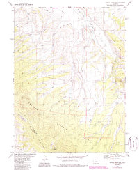
1979 Map of Battle Mountain
USGS Topo · Published 1988About this map
The high-altitude drainage systems of the Williams Fork Mountains define this section of the Arapaho National Forest during the late 1970s and 1980s. Water management is a primary feature of the landscape, evidenced by the Big Lake Ditch traversing the northern slopes near Jessmer. The terrain is dominated by Battle Mountain and Williams Peak, with the boundary between Grand and Summit Counties following the primary ridgelines. Early resource extraction and local transport are visible through the presence of Gravel Pits, a remote Landing Strip along the Williams Fork river, and various Jeep Trails that provide access to Copper Spring and the surrounding gulches. This survey provides a look at the intricate network of alpine tributaries including North Battle Creek, South Battle Creek, and Skylark Creek as they feed into the valley floor.
Find a feature on this map
29 named features on this map. Tap any name to fly to it.
Don’t see what you’re looking for? This feature index may not catch every label — zoom into the map to look around manually.
Map Details
Editions of this 1979 Battle Mountain Map
4 editions found
Other maps of this area

1933 · Mt. Powell
USGS Topo · 1:48,000

1933 · Ute Peak
USGS Topo · 1:62,500

1937 · Ute Peak
USGS Topo · 1:62,500

1940 · Mount Powell
USGS Topo · 1:62,500

1954 · Craig
USGS Topo · 1:250,000

1956 · Kremmling
USGS Topo · 1:62,500

1957 · Craig
USGS Topo · 1:250,000

1957 · Hot Sulphur Springs
USGS Topo · 1:62,500

1957 · Leadville
USGS Topo · 1:250,000

1958 · Craig
USGS Topo · 1:250,000