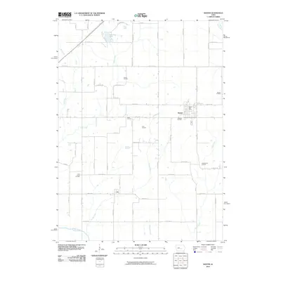
2010 Map of Baxter
USGS Topo · Published 2010About this map
The town of Baxter serves as the primary hub of this Iowa landscape, where the Baxter Post Office remains a central landmark for the local community. The surrounding countryside is defined by an extensive network of cemeteries that speak to the long-standing family roots in the area, including Restland Cemetery near the town center and the outlying Union Chapel Cemetery and Independence Cemetery. The terrain is characterized by the drainages of Turkey Creek, Clear Creek, and Prairie Creek, which carve through the grid of agricultural roads.
Find a feature on this map
57 named features on this map. Tap any name to fly to it.
Don’t see what you’re looking for? This feature index may not catch every label — zoom into the map to look around manually.
Map Details
Editions of this 2010 Baxter Map
This is the sole edition of this map. No revisions or reprints were ever made.
Other maps of this area

1930 · Mitchellville
USGS Topo · 1:62,500

1954 · Des Moines
USGS Topo · 1:250,000

1956 · Des Moines
USGS Topo · 1:250,000

1957 · Des Moines
USGS Topo · 1:250,000

1965 · Newton
USGS Topo · 1:24,000

1965 · Colfax
USGS Topo · 1:24,000

1969 · Des Moines
USGS Topo · 1:250,000
1972 · Mitchellville
USGS Topo · 1:24,000

1975 · Mingo
USGS Topo · 1:24,000

1975 · Rhodes
USGS Topo · 1:24,000
Featured Places
- Baxter, IA
- Independence Township, IA
- Collins Township, IA
- Poweshiek Township, IA
- Clear Creek Township, IA