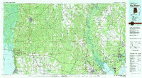
1981 Map of Bay Minette
USGS Topo · Published 1981About this map
The confluence of the Mobile River, Tensaw River, and Alabama River creates a complex network of waterways and islands at the head of Mobile Bay. This 1981 record captures the developing corridor between Bay Minette and the eastern shore, where towns like Daphne and Fairhope were growing alongside established agricultural centers. The landscape is defined by the delta's intricate geography, featuring landmarks such as Mound Island and Twenty-seven Mile Bluff, which hint at a long history of river-based commerce and habitation. To the east, the Perdido River marks the state line, while the Escambia River basin dominates the Florida side near Cantonment. Military aviation infrastructure is prominent across the region, indicated by several outlying fields such as OLF Silverhill US Navy and OLF Site 8A US Navy, serving the naval air stations of the Gulf Coast.
Find a feature on this map
102 named features on this map. Tap any name to fly to it.
Don’t see what you’re looking for? This feature index may not catch every label — zoom into the map to look around manually.
Map Details
Editions of this 1981 Bay Minette Map
2 editions found
Other maps of this area

1920 · Milton
USGS Topo · 1:62,500

1920 · Robertsdale
USGS Topo · 1:62,500

1921 · Holley
USGS Topo · 1:62,500

1921 · Bon Secour
USGS Topo · 1:62,500

1921 · Pensacola
USGS Topo · 1:62,500

1921 · Point Clear
USGS Topo · 1:62,500

1921 · Fairhope
USGS Topo · 1:62,500

1921 · Fort Barrancas
USGS Topo · 1:62,500

1921 · Muscogee
USGS Topo · 1:62,500

1921 · Delchamps
USGS Topo · 1:62,500