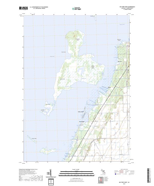
2023 Map of Bay Port West
USGS Topo · Published 2023About this map
Wild Fowl Bay and the marshy expanses of Saginaw Bay dominate this coastal survey of Huron County, where the transition from water to land is defined by a complex archipelago of low-lying islands. Local navigation is traced through a series of engineered channels including Boxcar Cut, Rush Cut, and Blind Pass, which weave through the Middle Grounds. These waterways emphasize the area's history as a hub for commercial fishing and waterfowl hunting near the settlement of Bay Port. Onshore, the landscape is gridded by rural roads such as S Unionville Rd and Kilmanagh Rd, connecting small coastal communities like Rose Island and Valley Island. For those tracing local roots, the Bay Port Cem serves as a significant genealogical marker near the shoreline. The intricate coastline includes distinctive features like Heisterman Island and the scattered remnants of Pitchers Reef.
Find a feature on this map
48 named features on this map. Tap any name to fly to it.
Don’t see what you’re looking for? This feature index may not catch every label — zoom into the map to look around manually.
Map Details
Editions of this 2023 Bay Port West Map
This is the sole edition of this map. No revisions or reprints were ever made.
Other maps of this area

1954 · Flint
USGS Topo · 1:250,000

1958 · Flint
USGS Topo · 1:250,000

1963 · Fish Point
USGS Topo · 1:24,000

1963 · Owendale
USGS Topo · 1:24,000

1963 · Sebewaing
USGS Topo · 1:24,000

1970 · Bay Port West
USGS Topo · 1:24,000

1970 · Bay Port East
USGS Topo · 1:24,000

1970 · Caseville
USGS Topo · 1:24,000

1970 · Sand Point
USGS Topo · 1:24,000
1984 · Bay City
USGS Topo · 1:100,000