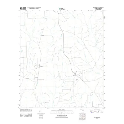
2012 Map of Bay Springs
USGS Topo · Published 2012About this map
The community of Bay Springs anchors this portion of northwestern Florida, situated at the junction of Co Hwy 97A and Co Hwy 99. North of the settlement, the landscape is defined by the winding paths of McDavid Cr and McDade Cr, which drain through the local timber and agricultural lands of northern Escambia County. This 2012 survey illustrates the modern rural infrastructure of the area, including the residential clusters at McKinnon and the small aviation facility at Mc Kinnon Airpark. The drainage patterns are intricate, with numerous small tributaries like Still Br and Pond Br feeding into larger systems such as Blue Water Cr and Pine Barren Cr. The network of local roads, such as Tungoil Rd and Sunshine Hill Rd, provides a detailed look at contemporary land division and access in this panhandle region.
Find a feature on this map
41 named features on this map. Tap any name to fly to it.
Don’t see what you’re looking for? This feature index may not catch every label — zoom into the map to look around manually.
Map Details
Editions of this 2012 Bay Springs Map
This is the sole edition of this map. No revisions or reprints were ever made.
Other maps of this area

1920 · Robertsdale
USGS Topo · 1:62,500

1921 · Muscogee
USGS Topo · 1:62,500

1941 · Muscogee
USGS Topo · 1:62,500

1941 · Robertsdale
USGS Topo · 1:62,500

1941 · Century
USGS Topo · 1:62,500

1942 · Dyas
USGS Topo · 1:62,500

1943 · Robertsdale
USGS Topo · 1:62,500

1943 · Muscogee
USGS Topo · 1:62,500

1943 · Century
USGS Topo · 1:62,500

1944 · Dyas
USGS Topo · 1:62,500