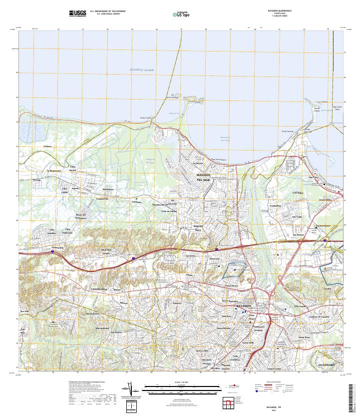
2024 Map of Bayamon
USGS Topo · Published 2024About this map
Bayamón and its surrounding municipalities are defined by a complex network of urban expansion and coastal geography along the Atlantic Ocean. The region serves as a major hub for higher education and civic administration, evidenced by institutions like the Universidad Central de Bayamón and the Centro Judicial de Bayamón. The landscape is a mix of dense residential neighborhoods such as Levittown and Sabana Seca, and significant federal and historic sites including Fort Buchanan and a portion of the San Juan National Historic Site near Isla de Cabras.
Find a feature on this map
128 named features on this map. Tap any name to fly to it.
Don’t see what you’re looking for? This feature index may not catch every label — zoom into the map to look around manually.
Map Details
Editions of this 2024 Bayamon Map
This is the sole edition of this map. No revisions or reprints were ever made.
Other maps of this area

1940 · Vega Alta
USGS Topo · 1:30,000

1941 · Bayamon
USGS Topo · 1:30,000

1941 · San Juan
USGS Topo · 1:30,000

1946 · Aguas Buenas
USGS Topo · 1:30,000

1946 · Corozal
USGS Topo · 1:30,000

1946 · Vega Alta
USGS Topo · 1:30,000

1946 · Naranjito
USGS Topo · 1:30,000
1947 · Corozal NE
USGS Topo · 1:10,000

1947 · Aguas Buenas NO
USGS Topo · 1:10,000

1947 · Bayamon
USGS Topo · 1:30,000