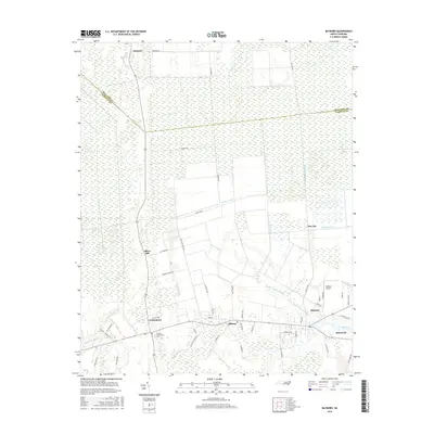
2016 Map of Bayboro
USGS Topo · Published 2016About this map
Low-lying marshlands and a dense network of drainage canals define this part of the Inner Banks, where the coastal landscape meets the Bay River. The county seat of Bayboro and neighboring Stonewall anchor the southeastern corner of the quadrangle, serving as the primary centers of commerce and governance for this rural section of Pamlico County. The human footprint here is shaped entirely by the water, seen in the extensive engineering of the Main Canal, Bonner Canal, and Sawyer Canal, which facilitate agriculture across the flat, swampy terrain of Gum Swamp.
Find a feature on this map
63 named features on this map. Tap any name to fly to it.
Don’t see what you’re looking for? This feature index may not catch every label — zoom into the map to look around manually.
Map Details
Editions of this 2016 Bayboro Map
This is the sole edition of this map. No revisions or reprints were ever made.
Other maps of this area

1948 · Oriental
USGS Topo · 1:24,000

1950 · Vandemere
USGS Topo · 1:24,000

1950 · South Creek
USGS Topo · 1:24,000

1950 · Aurora
USGS Topo · 1:24,000

1950 · Edward
USGS Topo · 1:24,000

1950 · Upper Broad Creek
USGS Topo · 1:24,000

1950 · Arapahoe
USGS Topo · 1:24,000

1951 · Arapahoe
USGS Topo · 1:24,000

1951 · Upper Broad Creek
USGS Topo · 1:24,000

1953 · Rocky Mount
USGS Topo · 1:250,000