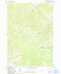
1963 Map of Bayhorse Lake
USGS Topo · Published 1991About this map
Tollgate Ruins and Bruno Cabin Ruins sit within the high elevations of the Challis National Forest, providing evidence of early settlement and travel in the mountains of Custer County. Surveyed in the early 1960s, this area is defined by a dense network of watercourses, including Mill Creek, Rough Creek, and Bayhorse Creek, which flow through steep gulches like Spruce Gulch and North Gulch.
Find a feature on this map
31 named features on this map. Tap any name to fly to it.
Don’t see what you’re looking for? This feature index may not catch every label — zoom into the map to look around manually.
Map Details
Editions of this 1963 Bayhorse Lake Map
4 editions found

Other maps of this area

1919 · Custer
USGS Topo · 1:125,000

1922 · Custer
USGS Topo · 1:125,000

1929 · Bayhorse
USGS Topo · 1:125,000

1930 · Casto
USGS Topo · 1:125,000

1956 · Twin Peaks
USGS Topo · 1:62,500

1957 · Challis
USGS Topo · 1:250,000

1960 · Challis
USGS Topo · 1:250,000

1963 · Challis
USGS Topo · 1:250,000

1963 · Challis Creek Lakes
USGS Topo · 1:24,000

1963 · Bald Mountain
USGS Topo · 1:24,000