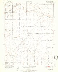
1950 Map of Bayneville
USGS Topo · Published 1952About this map
Atchison Topeka and Santa Fe and Missouri Pacific railroad lines dominate the rural landscape of south-central Kansas in the early 1950s. This agricultural region is defined by a grid of townships including Illinois, Waco, Ninnescah, and Ohio, where small settlements like Schulte and Bayneville serve as local hubs along the tracks. The topography is marked by the winding paths of Cowskin Creek and Spring Creek, which feed into local catchments such as Wattles Lake. Local history is anchored by landmarks of community life, including the Richmond Hill Sch and Greenwood Cem. An Airway Beacon located in Ohio township points to the era's developing aviation infrastructure, while the canal construction near Oatville suggests ongoing efforts in water management and irrigation to support the surrounding farmland.
Find a feature on this map
19 named features on this map. Tap any name to fly to it.
Don’t see what you’re looking for? This feature index may not catch every label — zoom into the map to look around manually.
Map Details
Editions of this 1950 Bayneville Map
2 editions found

Other maps of this area

1889 · Cheney
USGS Topo · 1:125,000

1889 · Wichita
USGS Topo · 1:125,000

1889 · Caldwell
USGS Topo · 1:125,000

1890 · Wellington
USGS Topo · 1:125,000

1891 · Cheney
USGS Topo · 1:125,000

1893 · Caldwell
USGS Topo · 1:125,000

1894 · Wichita
USGS Topo · 1:125,000

1897 · Caldwell
USGS Topo · 1:125,000

1901 · Cheney
USGS Topo · 1:125,000

1943 · Wichita West
USGS Topo · 1:31,680