
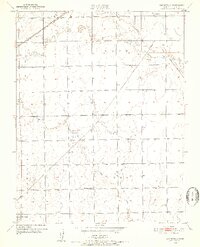
1950 Map of Bayneville
USGS Topo · Published 1952About this map
The agrarian landscape of Sedgwick County is defined here by the winding course of Cowskin Creek and its many tributaries, such as Dry Creek and Spring Creek. Small rail-dependent settlements punctuate the grid of section lines, including Schulte in the north and the map's namesake, Bayneville, situated near the center. The Missouri Pacific and the Atchison Topeka and Santa Fe railroads provide the primary transportation arteries, linking these rural outposts. Local history is anchored by communal landmarks like Greenwood Cem and Richmond Hill Sch, which served the scattered farmstead families in Waco and Ninnescah townships. The presence of an Airway Beacon in Ohio township reflects the mid-century intersection of traditional prairie agriculture with early modern aviation infrastructure.
Find a feature on this map
18 named features on this map. Tap any name to fly to it.
Don’t see what you’re looking for? This feature index may not catch every label — zoom into the map to look around manually.
Map Details
Editions of this 1950 Bayneville Map
2 editions found
Other maps of this area

1889 · Cheney
USGS Topo · 1:125,000

1889 · Wichita
USGS Topo · 1:125,000

1889 · Caldwell
USGS Topo · 1:125,000

1890 · Wellington
USGS Topo · 1:125,000

1891 · Cheney
USGS Topo · 1:125,000

1893 · Caldwell
USGS Topo · 1:125,000

1894 · Wichita
USGS Topo · 1:125,000

1897 · Caldwell
USGS Topo · 1:125,000

1901 · Cheney
USGS Topo · 1:125,000

1943 · Wichita West
USGS Topo · 1:31,680