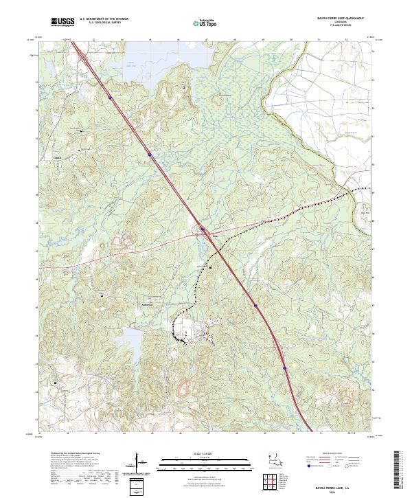
2024 Map of Bayou Pierre Lake
USGS Topo · Published 2024About this map
Red River National Wildlife Refuge dominates the central wetlands of this De Soto Parish landscape, where the waters of Smithport Lake and Bayou Pierre Lake meet at Chicot Island. The area reflects a deep-rooted rural community characterized by numerous family and community burial grounds, including Bethlehem Cem, Woodvine Cem, and Truevine Cem. These landmarks, along with the DeSoto Fire Tower, provide essential touchstones for genealogical research in a region defined by its bayous and creek systems.
Find a feature on this map
53 named features on this map. Tap any name to fly to it.
Don’t see what you’re looking for? This feature index may not catch every label — zoom into the map to look around manually.
Map Details
Editions of this 2024 Bayou Pierre Lake Map
This is the sole edition of this map. No revisions or reprints were ever made.
Other maps of this area

1938 · Chemard Lake
USGS Topo · 1:31,680

1941 · East Point
USGS Topo · 1:31,680

1941 · Pelican
USGS Topo · 1:62,500

1943 · Pleasant Hill
USGS Topo · 1:62,500

1944 · Pleasant Hill
USGS Topo · 1:62,500

1945 · Mansfield
USGS Topo · 1:62,500

1947 · Mansfield
USGS Topo · 1:62,500

1947 · Hanna
USGS Topo · 1:62,500

1948 · Coushatta
USGS Topo · 1:62,500

1953 · Alexandria
USGS Topo · 1:250,000