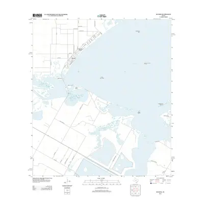
2013 Map of Bayside
USGS Topo · Published 2013About this map
Bayside and the nearby Old Saint Marys settlement occupy the western shore of Copano Bay in this coastal Texas survey. The landscape is defined by the shallow waters and ecological features of the bay system, including Snellbank Reef and Forty Acre Reef. The transition from land to water is marked by points such as Black Point and the delta where the Aransas River meets the bay.
Find a feature on this map
48 named features on this map. Tap any name to fly to it.
Don’t see what you’re looking for? This feature index may not catch every label — zoom into the map to look around manually.
Map Details
Editions of this 2013 Bayside Map
This is the sole edition of this map. No revisions or reprints were ever made.
Other maps of this area

1925 · Aransas Pass
USGS Topo · 1:62,500

1925 · Corpus Christi
USGS Topo · 1:62,500

1950 · Corpus Christi
USGS Topo · 1:250,000

1951 · Corpus Christi
USGS Topo · 1:62,500

1953 · Beeville
USGS Topo · 1:250,000

1954 · Rockport
USGS Topo · 1:62,500

1954 · Aransas Pass
USGS Topo · 1:24,000

1954 · Woodsboro
USGS Topo · 1:62,500

1954 · Estes
USGS Topo · 1:24,000

1954 · Aransas Pass
USGS Topo · 1:62,500
Featured Places
- Bayside, TX
- Bayview Estates Colonia, TX
- Old Saint Marys, Bayside
- San Patricio County, TX
- Aransas County, TX