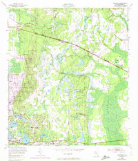
1949 Map of Baywood
USGS Topo · Published 1972About this map
Interlachen and the surrounding pine flatwoods and cypress wetlands of Putnam County are captured here in a period of transition, based on data from 1949 with later 1970 revisions. The landscape is defined by its complex hydrology, with numerous sinkhole lakes such as Up and Down Lake, Junior Lake, and Boll Green Lake dotting the sandy terrain. Transport is dominated by two primary rail corridors: the Southern line passing through Baywood and Carraway, and the Seaboard Coast Line further south near Mannville. The eastern portion of the map is dominated by the sprawling Swamp lands of Rice Creek, where numerous tributaries like Palmetto Branch and Oldtown Branch drain into the low-lying basin. Genealogists will find the Mannville Cem located near the southern edge, serving the small lakeside communities that grew up along the rail lines and regional waterways.
Find a feature on this map
22 named features on this map. Tap any name to fly to it.
Don’t see what you’re looking for? This feature index may not catch every label — zoom into the map to look around manually.
Map Details
Editions of this 1949 Baywood Map
3 editions found

Other maps of this area

1912 · Palatka
USGS Topo · 1:48,000

1915 · Palatka
USGS Topo · 1:62,500

1915 · Interlachen
USGS Topo · 1:48,000

1916 · Interlachen
USGS Topo · 1:62,500

1942 · Ates Creek
USGS Topo · 1:62,500

1944 · Interlachen
USGS Topo · 1:62,500

1947 · Bostwick
USGS Topo · 1:50,000

1949 · Rice Creek
USGS Topo · 1:24,000

1949 · Bostwick
USGS Topo · 1:24,000

1949 · Keuka
USGS Topo · 1:24,000