1963 Map of Beach
USGS Topo · Published 1981About this map
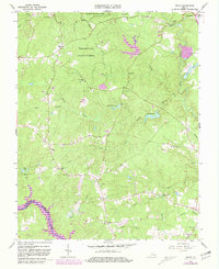
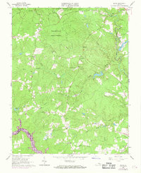
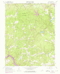
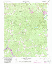
The Pocahontas State Park and adjacent Pocahontas State Forest dominate this Chesterfield County landscape, which was updated in 1980 to reflect changes in woodland and development since the early 1960s. The area maintains a rural, forested character defined by drainage systems like First Branch, Second Branch, and Swift Creek, which feeds into the larger Lake Dale and Crostick Millpond. For genealogists and local historians, the map is a dense source of community landmarks, including the namesake settlement of Beach and the small crossroads of Rita. Significant family and congregational sites are scattered throughout, such as the Mt Gilead Ch and Mt Gilead Cem, alongside several educational landmarks like the Union Branch Sch and Union Grove Sch. The southern boundary is marked by the winding path of the Appomattox River, delineating the border between Chesterfield and Dinwiddie counties.
Find a feature on this map
48 named features on this map. Tap any name to fly to it.
Don’t see what you’re looking for? This feature index may not catch every label — zoom into the map to look around manually.
Map Details
Editions of this 1963 Beach Map
5 editions found

Other maps of this area

1894 · Bermuda Hundred
USGS Topo · 1:62,500

1894 · Petersburg
USGS Topo · 1:62,500

1897 · Amelia
USGS Topo · 1:125,000

1938 · Drewrys Bluff
USGS Topo · 1:24,000

1943 · Chesterfield
USGS Topo · 1:31,680

1943 · Hallsboro
USGS Topo · 1:31,680

1943 · Beach
USGS Topo · 1:24,000

1943 · Church Road
USGS Topo · 1:24,000

1943 · Winterpock
USGS Topo · 1:24,000

1943 · Sutherland
USGS Topo · 1:24,000