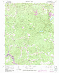
1963 Map of Beach
USGS Topo · Published 1987About this map
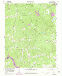
Pocahontas State Park and the expansive Pocahontas State Forest dominate the northern half of this landscape, where the wooded terrain is dissected by numerous waterways including Third Branch and First Branch. In the center, Crosstick Millpond and Lake Margaret reflect a regional water management system that feeds into the Swift Creek drainage. The map reveals a deeply rooted social geography, with the settlement of Beach serving as a focal point near several family-named landmarks and cemeteries.
Find a feature on this map
43 named features on this map. Tap any name to fly to it.
Don’t see what you’re looking for? This feature index may not catch every label — zoom into the map to look around manually.
Map Details
Editions of this 1963 Beach Map
5 editions found
Other maps of this area

1894 · Bermuda Hundred
USGS Topo · 1:62,500

1894 · Petersburg
USGS Topo · 1:62,500

1897 · Amelia
USGS Topo · 1:125,000

1938 · Drewrys Bluff
USGS Topo · 1:24,000

1943 · Chesterfield
USGS Topo · 1:31,680

1943 · Hallsboro
USGS Topo · 1:31,680

1943 · Beach
USGS Topo · 1:24,000

1943 · Church Road
USGS Topo · 1:24,000

1943 · Winterpock
USGS Topo · 1:24,000

1943 · Sutherland
USGS Topo · 1:24,000