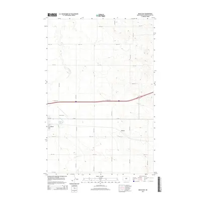
2014 Map of Beach East
USGS Topo · Published 2014About this map
Beach sits at the western edge of this Golden Valley County landscape, where the local grid of Main St and 4th St NE transitions into the expansive agricultural sections of the North Dakota plains. The regional transportation network is anchored by the presence of Beach Airport and the modern path of Interstate 94, accompanied here by I-94 Frontage Rd. These routes cut through a terrain defined by subtle drainage patterns, most notably the winding course of Little Beaver Cr and the eastward flow of Andrews Cr. The map captures the quiet transition between the concentrated settlement at Beach and the outlying rural siding or locality of Chama. A dense network of section line roads, such as 167th Ave SW and 30th St SW, organizes the territory into the traditional township-and-range blocks characteristic of the American West.
Find a feature on this map
22 named features on this map. Tap any name to fly to it.
Don’t see what you’re looking for? This feature index may not catch every label — zoom into the map to look around manually.
Map Details
Editions of this 2014 Beach East Map
This is the sole edition of this map. No revisions or reprints were ever made.
Other maps of this area

1909 · Glendive
USGS Topo · 1:250,000

1953 · Miles City
USGS Topo · 1:250,000

1953 · Dickinson
USGS Topo · 1:250,000

1953 · Watford City
USGS Topo · 1:250,000

1954 · Glendive
USGS Topo · 1:250,000

1957 · Dickinson
USGS Topo · 1:250,000

1957 · Miles City
USGS Topo · 1:250,000

1957 · Glendive
USGS Topo · 1:250,000

1957 · Watford City
USGS Topo · 1:250,000

1958 · Miles City
USGS Topo · 1:250,000