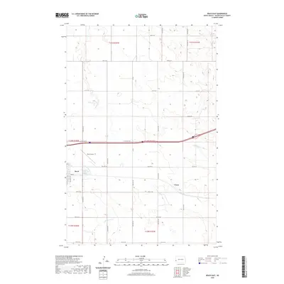
2020 Map of Beach East
USGS Topo · Published 2020About this map
Beach serves as the primary hub in this western North Dakota landscape, situated along the historic corridor of Old Hwy 10. The map illustrates a high plains environment defined by its rectilinear section lines and a transport network that evolved from early trails to the interstate era. To the east, the small settlement of Chama appears along the rail and road path, while the Beach Airport north of town highlights the area's modern connectivity. The drainage patterns of Little Beaver Creek and Andrews Creek break the grid-like regularity of the township and range system, providing the primary topographic variation across these agricultural lands. This survey reflects the enduring spatial organization of Golden Valley County, where modern infrastructure remains closely aligned with the legacy of original land surveys and early twentieth-century transit routes.
Find a feature on this map
22 named features on this map. Tap any name to fly to it.
Don’t see what you’re looking for? This feature index may not catch every label — zoom into the map to look around manually.
Map Details
Editions of this 2020 Beach East Map
This is the sole edition of this map. No revisions or reprints were ever made.
Other maps of this area

1909 · Glendive
USGS Topo · 1:250,000

1953 · Miles City
USGS Topo · 1:250,000

1953 · Dickinson
USGS Topo · 1:250,000

1953 · Watford City
USGS Topo · 1:250,000

1954 · Glendive
USGS Topo · 1:250,000

1957 · Dickinson
USGS Topo · 1:250,000

1957 · Miles City
USGS Topo · 1:250,000

1957 · Glendive
USGS Topo · 1:250,000

1957 · Watford City
USGS Topo · 1:250,000

1958 · Miles City
USGS Topo · 1:250,000