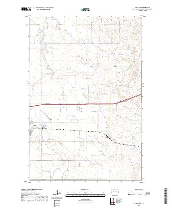
2024 Map of Beach East
USGS Topo · Published 2024About this map
Beach serves as the primary hub of activity in this pocket of Golden Valley County, situated along the path of Old Hwy 10. The landscape is defined by the winding course of Little Beaver Creek, which meanders through the western and southern sections of the quadrangle. North of the town, the Beach Airport provides an essential connection for this agricultural region, while to the east, the small settlement of Chama sits along the section lines near the drainage of Andrews Creek. The map documents a meticulously surveyed grid of township and range lines, with a network of local roads such as 166th Ave SW and 32nd St SW providing access to the wide, open plains of the North Dakota badlands fringe. This 2024 data reflects the modern infrastructure of the western edge of the state, where interstate transit and rural farm roads converge.
Find a feature on this map
30 named features on this map. Tap any name to fly to it.
Don’t see what you’re looking for? This feature index may not catch every label — zoom into the map to look around manually.
Map Details
Editions of this 2024 Beach East Map
This is the sole edition of this map. No revisions or reprints were ever made.
Other maps of this area

1909 · Glendive
USGS Topo · 1:250,000

1953 · Miles City
USGS Topo · 1:250,000

1953 · Dickinson
USGS Topo · 1:250,000

1953 · Watford City
USGS Topo · 1:250,000

1954 · Glendive
USGS Topo · 1:250,000

1957 · Dickinson
USGS Topo · 1:250,000

1957 · Miles City
USGS Topo · 1:250,000

1957 · Glendive
USGS Topo · 1:250,000

1957 · Watford City
USGS Topo · 1:250,000

1958 · Miles City
USGS Topo · 1:250,000