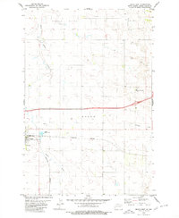
1980 Map of Beach East
USGS Topo · Published 1980About this map
Little Beaver Creek and Andrews Creek carve through the high plains of Golden Valley County, framing the eastern edge of Beach, North Dakota. In the early 1980s, the community functioned as a critical shipping point for the region's agricultural output, evidenced by the Grain Elevator and the heavy-duty rails of the Burlington Northern line. The infrastructure of the town is well-documented, including the local Airport, an Athletic Field, and Sewage Disposal Ponds west of the main settlement.
Find a feature on this map
22 named features on this map. Tap any name to fly to it.
Don’t see what you’re looking for? This feature index may not catch every label — zoom into the map to look around manually.
Map Details
Editions of this 1980 Beach East Map
This is the sole edition of this map. No revisions or reprints were ever made.
Other maps of this area

1909 · Glendive
USGS Topo · 1:250,000

1953 · Miles City
USGS Topo · 1:250,000

1953 · Dickinson
USGS Topo · 1:250,000

1953 · Watford City
USGS Topo · 1:250,000

1954 · Glendive
USGS Topo · 1:250,000

1957 · Dickinson
USGS Topo · 1:250,000

1957 · Miles City
USGS Topo · 1:250,000

1957 · Glendive
USGS Topo · 1:250,000

1957 · Watford City
USGS Topo · 1:250,000

1958 · Miles City
USGS Topo · 1:250,000