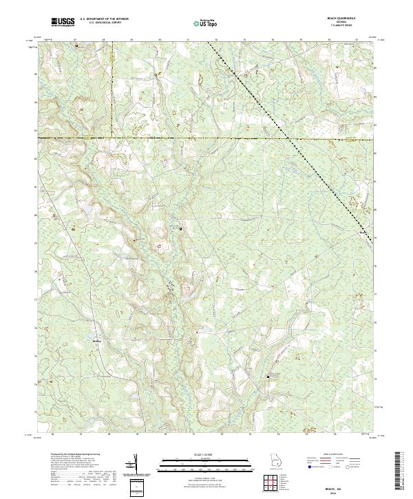
2024 Map of Beach
USGS Topo · Published 2024About this map
The lowlands of Ware County meet the borders of Coffee and Bacon counties in this recent survey, defined by the slow-moving waters of Hog Creek and Hurricane Creek. The landscape is largely rural, characterized by timberlands and agriculture accessed via a network of named local roads like White Pine Hwy and Cherry Tree Rd. The small settlements of Beach and Bickley serve as local anchors, while the presence of the Liberty Baptist Church Cem suggests the long-standing community ties in this corner of Georgia.
Find a feature on this map
72 named features on this map. Tap any name to fly to it.
Don’t see what you’re looking for? This feature index may not catch every label — zoom into the map to look around manually.
Map Details
Editions of this 2024 Beach Map
This is the sole edition of this map. No revisions or reprints were ever made.
Other maps of this area

1953 · Waycross
USGS Topo · 1:250,000

1958 · Waycross
USGS Topo · 1:250,000

1971 · Dixie Union
USGS Topo · 1:24,000

1971 · Nicholls
USGS Topo · 1:24,000

1971 · Wilsonville
USGS Topo · 1:24,000

1971 · Beach
USGS Topo · 1:24,000

1971 · Axson
USGS Topo · 1:24,000

1971 · Alma
USGS Topo · 1:24,000

1971 · Sessoms
USGS Topo · 1:24,000

1971 · Talmo
USGS Topo · 1:24,000