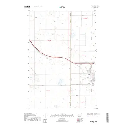
2018 Map of Beach West
USGS Topo · Published 2018About this map
The city of Beach anchors the eastern edge of this landscape, sitting just east of the state line between North Dakota and Montana. This region is characterized by a grid-like network of rural section-line roads, such as Black Diamond Rd and Mingus Rd, which traverse the high plains terrain. The drainage patterns of Hay Creek, Yates Creek, and Brophy Creek carve through the landscape, providing essential water sources for the agricultural operations that define the area's economy. Within the town limits of Beach, a dense concentration of local history is preserved at the Saint Johns Catholic Cemetery, Beach City Cemetery, and Beach Lutheran Cem. The transportation corridor is dominated by the modern interstate and its predecessor, Old Hwy 10, illustrating the evolution of cross-country travel through Golden Valley County.
Find a feature on this map
54 named features on this map. Tap any name to fly to it.
Don’t see what you’re looking for? This feature index may not catch every label — zoom into the map to look around manually.
Map Details
Editions of this 2018 Beach West Map
This is the sole edition of this map. No revisions or reprints were ever made.
Other maps of this area

1909 · Glendive
USGS Topo · 1:250,000

1953 · Miles City
USGS Topo · 1:250,000

1953 · Dickinson
USGS Topo · 1:250,000

1953 · Watford City
USGS Topo · 1:250,000

1954 · Glendive
USGS Topo · 1:250,000

1957 · Dickinson
USGS Topo · 1:250,000

1957 · Miles City
USGS Topo · 1:250,000

1957 · Glendive
USGS Topo · 1:250,000

1957 · Watford City
USGS Topo · 1:250,000

1958 · Miles City
USGS Topo · 1:250,000