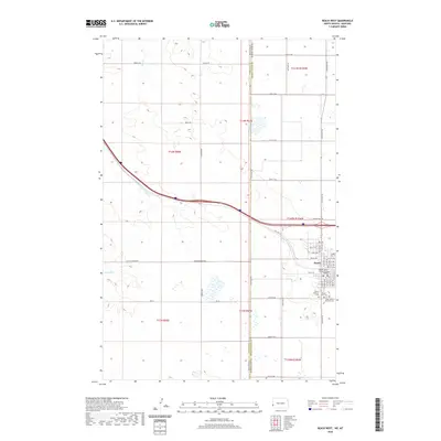
2020 Map of Beach West
USGS Topo · Published 2020About this map
Beach stands as the primary hub of this landscape, situated near the western edge of North Dakota. The town is anchored by the Golden Valley County Court House and serves as a focal point for several local burial grounds, including the Beach City Cem, Beach Lutheran Cem, and Saint Johns Catholic Cem. The surrounding terrain is defined by the drainage of Hay Cr and Yates Cr, which navigate a grid of rural roads and section lines.
Find a feature on this map
52 named features on this map. Tap any name to fly to it.
Don’t see what you’re looking for? This feature index may not catch every label — zoom into the map to look around manually.
Map Details
Editions of this 2020 Beach West Map
This is the sole edition of this map. No revisions or reprints were ever made.
Other maps of this area

1909 · Glendive
USGS Topo · 1:250,000

1953 · Miles City
USGS Topo · 1:250,000

1953 · Dickinson
USGS Topo · 1:250,000

1953 · Watford City
USGS Topo · 1:250,000

1954 · Glendive
USGS Topo · 1:250,000

1957 · Dickinson
USGS Topo · 1:250,000

1957 · Miles City
USGS Topo · 1:250,000

1957 · Glendive
USGS Topo · 1:250,000

1957 · Watford City
USGS Topo · 1:250,000

1958 · Miles City
USGS Topo · 1:250,000