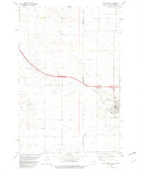
1982 Map of Beach West
USGS Topo · Published 1982About this map
The borderlands of western North Dakota and eastern Montana are defined here by a mix of agricultural infrastructure and extractive industry in the early 1980s. The city of Beach serves as a regional hub, featuring a local High Sch, Hospital, and a sprawling Golf Course. Just to the west, the Montana-North Dakota state line and the Wibaux and Golden Valley county boundaries divide the landscape. The Burlington Northern railroad corridor is central to the area's geography, running alongside Yates and through the heart of Beach, where a dedicated Port of Entry marks the transition between states.
Find a feature on this map
24 named features on this map. Tap any name to fly to it.
Don’t see what you’re looking for? This feature index may not catch every label — zoom into the map to look around manually.
Map Details
Editions of this 1982 Beach West Map
This is the sole edition of this map. No revisions or reprints were ever made.
Other maps of this area

1909 · Glendive
USGS Topo · 1:250,000

1953 · Miles City
USGS Topo · 1:250,000

1953 · Dickinson
USGS Topo · 1:250,000

1953 · Watford City
USGS Topo · 1:250,000

1954 · Glendive
USGS Topo · 1:250,000

1957 · Dickinson
USGS Topo · 1:250,000

1957 · Miles City
USGS Topo · 1:250,000

1957 · Glendive
USGS Topo · 1:250,000

1957 · Watford City
USGS Topo · 1:250,000

1958 · Miles City
USGS Topo · 1:250,000