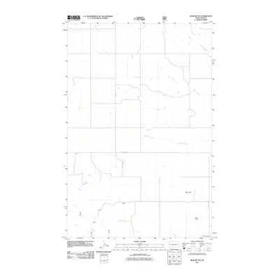
2011 Map of Bear Butte
USGS Topo · Published 2011About this map
Bear Butte rises as a prominent landmark in this section of McKenzie County, overlooking a landscape defined by seasonal watercourses and the agricultural grid of the North Dakota badlands. The northern reaches of the quadrangle are carved by the meandering paths of Antelope Creek and Cherry Creek, while the southern portion features the drainage of Red Wing Creek and the deep topographic indentation of Docs Draw. The map documents a sparse but vital human footprint, where section-line roads like County Rd-30 and County Rd-27 provide the primary infrastructure for ranching and transit. For local historians, the Red Wing Cemetery in the southeastern corner serves as a significant genealogical point of interest, marking the enduring presence of families in this expansive prairie environment.
Find a feature on this map
9 named features on this map. Tap any name to fly to it.
Don’t see what you’re looking for? This feature index may not catch every label — zoom into the map to look around manually.
Map Details
Editions of this 2011 Bear Butte Map
This is the sole edition of this map. No revisions or reprints were ever made.
Other maps of this area

1953 · Watford City
USGS Topo · 1:250,000

1957 · Watford City
USGS Topo · 1:250,000

1958 · Sperati Point
USGS Topo · 1:24,000

1958 · Stocke Butte
USGS Topo · 1:24,000

1967 · Watford City
USGS Topo · 1:250,000

1972 · Bear Butte
USGS Topo · 1:24,000

1972 · Alexander
USGS Topo · 1:24,000

1972 · Moline School
USGS Topo · 1:24,000

1972 · Rawson
USGS Topo · 1:24,000
1972 · Burning Mine Butte
USGS Topo · 1:24,000