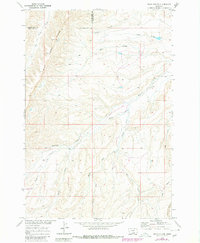
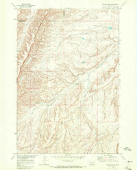
1968 Map of Bear Coulee
USGS Topo · Published 1980About this map
Wild Horse Ridge dominates the western horizon of this landscape within the Crow Indian Reservation, where the drainage patterns of the Missouri River Basin have carved a complex network of coulees and creeks. Surveyed in 1968, the terrain is defined by the convergence of several waterways, including the winding Beauvais Creek and the headwaters of the West Fork, Middle Fork, and East Fork. The map records a moment of transition for the local infrastructure, noting an unnamed road marked as under construction in the southwest quadrant, signaling 20th-century development into this interior portion of Big Horn County. The interface between Yellowstone and Big Horn counties is clearly delineated across the northern uplands, tracing a path through the breaks of Woody Creek and Bear Coulee.
Find a feature on this map
15 named features on this map. Tap any name to fly to it.
Don’t see what you’re looking for? This feature index may not catch every label — zoom into the map to look around manually.
Map Details
Editions of this 1968 Bear Coulee Map
2 editions found
Other maps of this area

1893 · Huntley
USGS Topo · 1:125,000

1954 · Billings
USGS Topo · 1:250,000

1957 · Billings
USGS Topo · 1:250,000

1958 · Billings
USGS Topo · 1:250,000
1964 · Horse Coulee
USGS Topo · 1:24,000
1964 · Grapevine Dome
USGS Topo · 1:24,000

1967 · Deep Creek SE
USGS Topo · 1:24,000

1967 · Soda Springs
USGS Topo · 1:24,000
1967 · Chilkoot Coulee
USGS Topo · 1:24,000
1968 · Bear Coulee
USGS Topo · 1:24,000