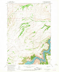
1964 Map of Grapevine Dome
USGS Topo · Published 1968About this map
Bighorn Canyon National Recreation Area dominates the eastern edge of this mid-1960s survey, illustrating the landscape of Big Horn County just as the Yellowtail Reservoir was being established. The map documents the complex topography where the Bighorn River cuts through deep gorges like Frozen Leg Canyon, set against the backdrop of Cooper Ridge.
Find a feature on this map
18 named features on this map. Tap any name to fly to it.
Don’t see what you’re looking for? This feature index may not catch every label — zoom into the map to look around manually.
Map Details
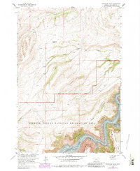
Editions of this 1964 Grapevine Dome Map
2 editions found
Other maps of this area

1894 · St. Xavier
USGS Topo · 1:125,000

1901 · St. Xavier
USGS Topo · 1:125,000

1915 · Spenceville
USGS Topo · 1:31,680

1954 · Billings
USGS Topo · 1:250,000

1954 · Hardin
USGS Topo · 1:250,000

1957 · Hardin
USGS Topo · 1:250,000

1957 · Billings
USGS Topo · 1:250,000

1958 · Billings
USGS Topo · 1:250,000

1958 · Hardin
USGS Topo · 1:250,000

1964 · Peyote Point
USGS Topo · 1:24,000