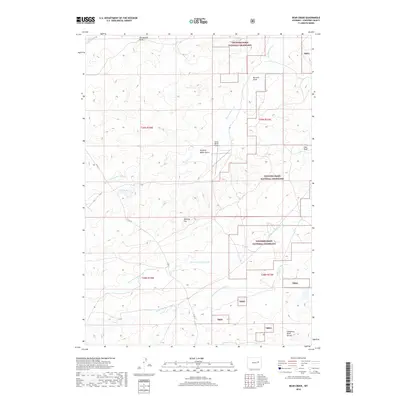
2018 Map of Bear Creek
USGS Topo · Published 2018About this map
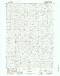
Thunder Basin National Grassland dominates this portion of Converse County, where the high plains terrain is defined by a network of drainage systems and ranching infrastructure. The Cheyenne River Divide serves as a significant topographical boundary in the southern reaches, overseeing the headwaters of the North Fork Bear Creek and South Fork Bear Creek. Human activity is primarily centered around land management and aviation, evidenced by the Hardy Ranch Airport located near Stinking Water Gulch. Transport through this open landscape relies on Co Rd 31, which connects various draws and flats including Hornbuckle Draw and Manning Flat. The presence of Coal Draw suggests the underlying geological resources common to the Powder River Basin region, while numerous labels like Bustard Draw and Stinking Water Cr reflect a naming convention deeply tied to the early livestock and ranching history of Wyoming.
Find a feature on this map
19 named features on this map. Tap any name to fly to it.
Don’t see what you’re looking for? This feature index may not catch every label — zoom into the map to look around manually.
Map Details
Editions of this 2018 Bear Creek Map
This is the sole edition of this map. No revisions or reprints were ever made.
Other maps of this area

1955 · Newcastle
USGS Topo · 1:250,000

1958 · Newcastle
USGS Topo · 1:250,000

1959 · Fifty-Five Ranch
USGS Topo · 1:62,500

1959 · Coal Draw
USGS Topo · 1:62,500
1959 · Highland Flats
USGS Topo · 1:62,500

1960 · Ross
USGS Topo · 1:62,500

1979 · Bill
USGS Topo · 1:100,000
1984 · Coal Draw North
USGS Topo · 1:24,000
1984 · Coal Draw South
USGS Topo · 1:24,000
1984 · Thompson Draw
USGS Topo · 1:24,000